6.7 Mw - GUERRERO, MEXICO
| Magnitude | 6.7 Mw |
| Date-Time |
|
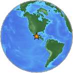
| Location | 18.038N 99.795W |
| Depth | 64 km |
| Distances |
|
| Location Uncertainty | Horizontal: 14.5 km; Vertical 9.8 km |
| Parameters | Nph = 488; Dmin = 140.3 km; Rmss = 0.78 seconds; Gp = 46° M-type = Mw; Version = 8 |
| Event ID | US c000753u |
For updates, maps, and technical information, see:
Event Page
or
USGS Earthquake Hazards Program
National Earthquake Information Center
U.S. Geological Survey
http://neic.usgs.gov/