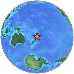
7.6 Mw - KERMADEC ISLANDS REGION
| Magnitude | 7.6 Mw |
| Date-Time |
|
| Location | 28.941S 176.045W |
| Depth | 39 km |
| Distances |
|
| Location Uncertainty | Horizontal: 15.7 km; Vertical 10.8 km |
| Parameters | Nph = 94; Dmin = 187.0 km; Rmss = 2.44 seconds; Gp = 50° M-type = Mw; Version = 5 |
| Event ID | US b0006b6p |
For updates, maps, and technical information, see:
Event Page
or
USGS Earthquake Hazards Program
National Earthquake Information Center
U.S. Geological Survey
http://neic.usgs.gov/